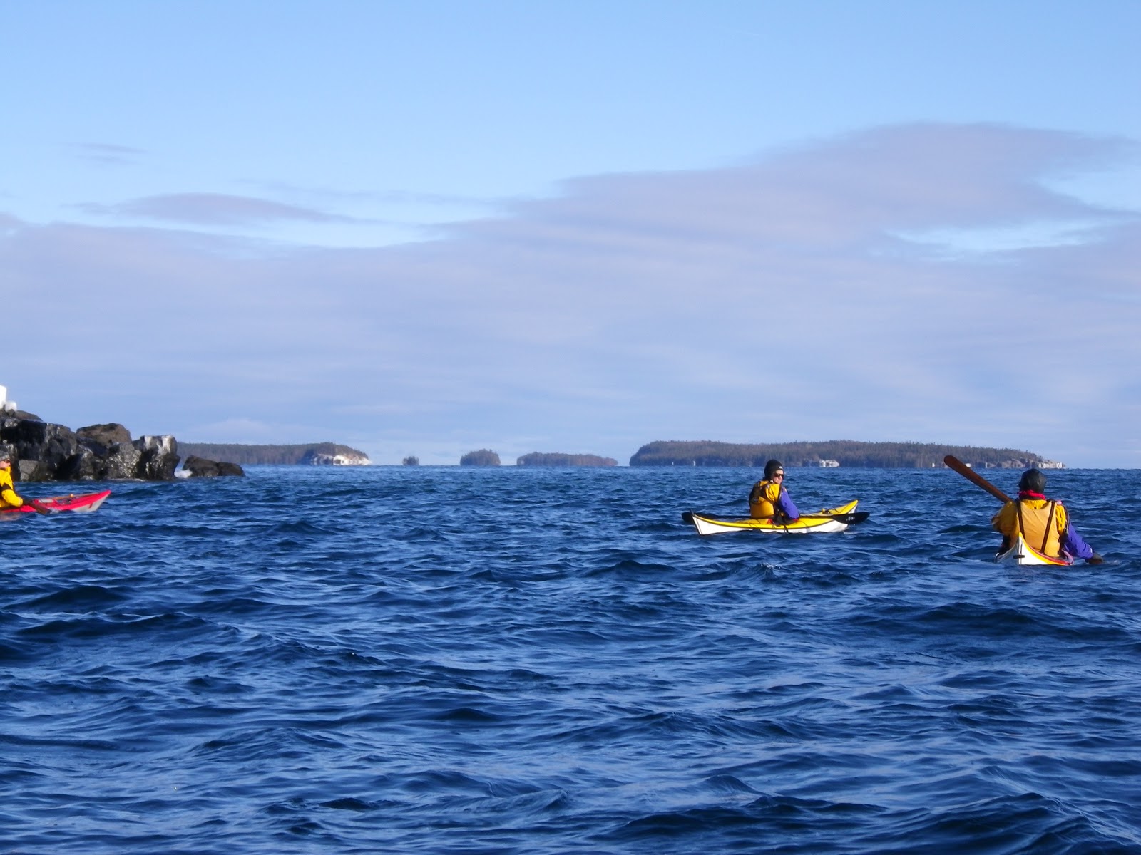
It also turned out that the trip had changed. Instead of staying in the relatively protected Prince William Sound, the group would paddle south as fast as possible to get to the Gulf of Alaska. If the weather window permitted, we would turn the corner at Cape Puget and paddle west along the Gulf of Alaska to Resurrection Bay. If the weather was not favorable, we'd spend a little time playing in the bigger water, then head back towards Whittier and probably take a water taxi back at some point.
Sea kayaking along the exposed coast of the Gulf of Alaska is riskier than staying in the sound. Once we started across Puget Bay, it would be 22 nautical miles to the next reliable place to land if the conditions were unfavorable. Winds of more than 30 knots can blow for days, and even the big boats don't venture out. There are no roads into the coast, so if you're out there in your kayak, you wait it out.
Which is a bit of a concern when you have a flight reservation, a job you hope to return to, and only the food you're carrying.
We were renting our boats from Tom Pogson of Alaska Kayak School, and he had been reluctant to let us make the attempt to go to Seward. Rumor had it that of the last 4 groups that had tried it, two had ended up calling in the Coast Guard. One was apparently due to a damaged boat and one was due to a need to get out according to a pre-determined schedule. So one of our group's ground rules for making the attempt for Seward was that Tom had to approve it. (We carried a satellite phone for that reason as well as for emergencies.) Another was that if we went, we wouldn't take unsafe chances just to make it back in time to catch a flight.
In May, we had a training weekend on the Menominee River. I missed the first day due a far more important event (my wonderful niece's wedding to a wonderful man), but I joined in on the second day. The expectations were a lot higher with the Alaska trip as our goal, and the training turned into more of a mental challenge for me than a physical one, as I started the day off badly and was feeling a day late and a dollar short all day. It was a perfect opportunity to put some of the mental game aspects that had come up in the San Juan Currents course into play. Ryan had some good coaching as well, and I managed to turn the day around eventually, but it was hard work.
After that, it was less than a month before we would meet in Alaska, and the time went too fast. We were all responsible for our own charts and current information and planning and research. We also watched the weather to get a sense of what the patterns were and what the range of conditions might be.
Training/paddling was also essential, as we would be paddling up to 30 nautical miles a day. I ended up testing the theory that paddling 8 – 10 miles 3 – 4 days a week would be enough; it was the best I could do.
On June 18, Tony and I flew out together, and Ryan met us at the airport in Anchorage. The rest of the group had arrived the night before and were picking up last minute items from REI. Our group of seven finally met at Humpy's restaurant in Anchorage for lunch. We all knew most of the group. I'd met Tony in our first sea kayaking class in 2008, and we've been paddling buddies ever since. I'd taken other GKC classes with Ryan, Mark, Sarah and Paul. I hadn't met Rich before, but he knew all the other folks. This was Mark's fifth Alaska trip, Paul had led the prior year's trip, and Ryan had paddled extensively in Alaska, so we had a lot of experience amongst us.
At lunch, Tony told the group about a couple calls he had made to get some local knowledge before the trip. One charter boat captain had been very helpful with information about currents in the channels we would be paddling through and where the whales were hanging out.
The sticking point, though, was clearly the part of the trip along the Gulf of Alaska. Another charter captain had left Tony a voice mail saying "You don't know how dangerous what you're talking about doing is. Please call me back so that I can talk to you about this. You really don't want to do it." (Tony hadn't called back.) Rich said that his Dad was familiar with the Gulf of Alaska and had said "Don't go."
(It did cross my mind that it was technically still possible to hop on a plane and head home at that point...)
After lunch, we headed to Whittier. We packed the group gear that afternoon, then went to the Swiftwater Seafood Café for the best fish and chips we'd ever had.
Day 1: (Days are hyperlinked to the GPS track/map for that day.) Next morning we were off. It was overcast, with the clouds settling lower down the mountains as the day went on. Whittier sits on the southern shore of the western end of Passage Canal, and we were headed east. We crossed over to the north side to see the kittiwake colony and thoroughly enjoyed watching them wheel and swirl overhead, then continued paddling east. We got the first of several interesting responses to our proposed destination when Ryan chatted briefly with a guide who was taking some folks out on a day trip. When he heard we were going to Seward, he said "Wow!"
We stopped at Decision Point for lunch. There was a splendid kitchen made of downed trees for Ryan to make lunch on, but the group proved to be quite slow at finding the lunch fixings in the group gear bags that had been hurriedly stashed and stuffed away into whatever nooks and crannies were available. You'd think nobody was hungry. I wouldn't go so far as to say that Ryan was getting a little testy about the lack of effort and progress, but he certainly appeared to be moving in that direction. The feta cheese didn't turn up for several days, but we eventually found the critical ingredients for the meal.
After lunch fog was lurking about, so instead of a direct crossing towards Culross Passage, we headed towards Blackstone Point, then over to Culross.
Culross Passage is about 10 miles long, and we wanted to reach it at the beginning of the ebb tide to get whatever assist was available heading south. There wasn't a lot of tidal current, but as Ryan pointed out, after a long day, even half a knot was welcome. We definitely wanted to get to the end before the flood tide.
Towards the end of the passage we started looking for a campsite, and we spent more time looking that night than any other. It had been a long day (about 25 nautical miles), and we explored several locations before we found a viable site. We also searched unsuccessfully for a cabin that was marked on the Trials Illustrated map. (A later search of the park websites didn't turn up any cabins at that location.) Our eventual campsite was the northernmost of the two kayak landing beaches marked on the Trails Illustrated map on the west side of the south end of Cullross Passage. Phantom cabins notwithstanding, the kayak landing beaches marked on the map seemed to be reliable kayak campsites. And throughout the trip, the long days of the Alaskan summer were handy when it came to late arrivals. There was at least one night when we didn't finish dinner and cleanup until after midnight.
On Day 2, we paddled past several fishing fleets. Mark explained how they worked and how to stay out of their way, and what to do if they offered us a fish (don't drop it!).
One of the captains who was working alone yelled at us for paddling over his net ("If you'd asked I would have said yes, but you can't paddle over someone's nets without asking!") A bit later, a friendlier fisherman called us over and offered us a fish. Sarah paddled up and took it and put it in her cockpit. Fish was not dropped. Way to go, Sarah.
We stopped for lunch at Eshamy Bay. Lovely bay, hordes of mosquitoes. Our lunch spot was chosen based on the need to find fresh water (we were looking for streams on the map and charts), so we filtered water while fending off the mosquitoes. (Note to self: bug shirts don't work at lunch stops while wearing a dry suit. Get a bug hat and keep in day hatch.). Our splendid fish was placed in an Ikea bag and weighted down in the water to chill while we lunched by the pretty waterfall and fed the bugs.
As we paddled away after lunch, we chatted with some fishermen who encouraged us to stop and check out the nearby Eshamy Bay Lodge. We didn't take the time to do that, but it seemed like a good destination if you ever wanted to visit Prince William Sound but not camp, or to break up a camping trip.
As we headed out of the bay, we had one of our many lessons on reading tides and currents. We paddled by an area where an island was blocking the current and Ryan played twenty questions as he tried to draw out how to read the current by the differences in wind against waves as opposed to wind with waves. When paddling on inland lakes, if one sees a patch of water where the waves look different, it's probably due to the wind being different. On the ocean, it's likely due to the interaction of wind and current -- wind with current smoothing the waves out and wind against current standing the waves up. Wouldn't it be clever to learn to read the water to paddle where the current is most in your favor? While one is working on that, turns out that it's helpful to pay attention if Ryan is paddling a very different route than everyone else.
Our second night's destination was Ewan Bay, where some of our group had camped before, though they didn't remember exactly where. The previous night we had more or less bonked when it came time to find a campsite, and Ryan ended up doing the scouting while we drifted rather aimlessly. Tonight we tried a different tactic ... everyone scattered in different directions looking for a campsite. Good idea to share the scouting, but a wee bit of planning about how to communicate might have been in order. We all eventually converged and found a nice site about halfway up the cove on the west side.
I took our water filter and walked the shore looking for a stream, but didn't find one. Paul ended up finding water farther into the woods. Another lesson learned … the wet spots by the shore may be tidal, or they may be fresh water streams that petered out before reaching the shore, with viable water sources a bit inland.
Red salmon for dinner. Yum!
On Day 3 we paddled to the head of the bay looking for an overfall where a lagoon separated from the bay continued to pour out long after low tide. No overfall, but there was a waterfall and an eddy line, and we spent half an hour or so playing in the current, which reminded us of the Menominee River.
After our play time, we split into two groups. Mark had picked up a bug that left him feeling pretty lousy the first half of the trip, and he and Ryan headed off to find a campsite at our evening's destination at Dual Head.
 Paul led Sarah, Rich, Tony and me to Nassau Glacier and then to Dual Head. We had lunch on Jackpot Island, in the mouth of Jackpot Bay The island had lovely sheltered landing sites on either side, so it would be a good place to stop in more than one wind direction.
As we approached Icy Bay, we started to see bits of brash ice. (Brash ice is less than 6 feet across). We were paddling into a decent headwind, so it was slower going. As we got closer, we could hear the ice tinkling as bits bumped into each other, and occasionally the scary sound made when a boat crunches against a bit of ice -- sounds much worse than it is. The water was noticeably colder as we approached the glacier.
Finally we turned the corner to see Nassau Glacier, a tidewater glacier that comes all the way down to the water. Well worth the paddle.

It would have been a long paddle to get appreciably closer to the glacier, so we turned around and headed back to Dual Head, a headland south of Icy Bay and north of Whale Bay. We were now paddling with the wind, which speeded up our progress. We passed a campsite or two before we found Ryan and Mark. Another group was in the process of landing on one of the sites. They asked where we were headed and again we got that pause/double take when we told them Seward.
Eventually we reached Dual Head. Nice site, though no water source. We ended up putting our kitchen sink bucket in a cave to catch drips over night, and had enough water in the morning to start out.
That evening, on our kitchen/dining room rock, Tony and I were talking when I heard something that sounded like a whale's spout that seemed very close by. We finally spotted the whales a mile or so away … it was such a quiet evening that the sound carried clearly across the water. We could see the spouts and sometimes the flukes as the whales dove.
Day 4: Next morning as we headed for Bainbridge Passage, we could still see the whales. As Tony said, "Whales for dinner and whales for breakfast!"
We pushed on to get through Bainbridge Passage before losing the ebb tide, then across Port Bainbridge. We paddled into and through a fog bank, and another bit of fog came down from our right before we stopped for lunch in a shallow bay just north of Auk Bay . We were pretty low on water at that point, and the chart showed a lake inland of us. Tony and I headed off up a dry creek bed (with lots of "hey bears" along the way) to look for it, but the creek bed was soon blocked by fallen trees, and bushwhacking soon proved untenable as we reached a ravine. We could hear water in the distance; we just couldn't see a way to get to it.
Back at camp, Rich and Paul tried another route and were again the heroes, bringing back fresh water. We all dozed after lunch as the water filtered.
Then we paddled around Cape Puget to camp on the gravel beach by East Lagoon, south of Goat Harbor in Puget Bay. The next day would be decision day on whether to head for Seward or not.
 Paddling into Puget Bay was a great idea for a couple of reasons. First, it got us closer to our destination. Second, rounding Cape Puget gave us a feel for what paddling along the headlands would be like. With all the comments and reactions and everything we had read about how dangerous this stretch could be, it was easy to build it up as bigger than it really was when the weather was as calm as it was.
Dinner was grilled pizza. Good paddling food.
Day 5: Next morning the weather window continued to look good, so we were off to Seward. Not without a little drama, though. There were a couple of stuck skegs, and Tony pulled out his knife to clear them. In the process, he got a bad cut. Rich the surgeon saved the day with super glue.
We started the journey we had been anticipating for so long in fog. It was frustrating to be on a stretch of dramatic coastline that very few people ever get a chance to paddle and not be able to see it, but the weather slowly cleared.
We passed a couple of rock gardens, and at first we all circled wide around them. Midwestern flat water paddlers, rented boats, a long way from help if we damaged anything – playing it safe made sense. But Ryan said "get in there!" Cape Resolution would be bigger than these headlands, and we needed to be comfortable in them. And ... we really were comfortable in them once we got in.
We also saw seals and sea otters. Also whales -- first in the distance, then a pair of humpbacks came along and swam near us.

I glanced to the right as we approached one of the headlands and was surprised to see two sea lions swimming along less than a boat length away from me. They seemed just as surprised to see me, and quickly dove. Soon we came to the headland and as we paddled by a rock, saw at least a dozen sea lions on the far side.
With the favorable conditions, we were able to land for lunch in Johnstone Bay. We checked the mileage to our destination and realized it was farther than we had been thinking, and considered our options. Paddling all the way to Day Harbor was more than we wanted to do, given that the weather forecast was stable and we weren't running out of time. We came up with a couple options for places to camp for the night and headed on.
With one last headland to round before our night's destination in Horsehead Bay, we found ourselves paddling hard but making no progress against the current. This was another point Ryan kept driving home: constantly using the shore to gauge your progress. Our options now were 1) paddle harder (could we? for long enough?), 2) turn around and backtrack, 3) keep doing what we were doing and hope something changed for the better, 4) look for an eddy.
Tony and I tried for the eddy line. It was there, and once we tucked in it became an easy paddle, but it took everything we had to get past the worst of the current into the eddy. Ryan and Sarah kept paddling the original course, and the current eased off.
The campsite at Horsehead Bay was delightful, and even had a lake to bathe near – coldish water, but being clean was a treat. And the mosquitoes had disappeared when we reached the open coast.
Day 6: We paddled across Day Harbor to Driftwood Bay, which set us up to round Cape Resurrection. We stopped for lunch and a break. Our plan was to round the cape at the slack water before the flood, so we had a chance to relax for a bit while we waited. Tony had heard that if one got trapped in Day Harbor in weather too bad to round the Cape, there was a portage across. We saw no sign of any portage; just high, steep cliffs, and there was no appetite for portaging once we saw them.
As we paddled south to the cape, we paddled by another kittiwake colony, even bigger than the one near Whittier, and we sat in our boats with silly grins on our faces as they flew about overhead.
 Ryan and Mark saw a large, high ceilinged cave and backed in, and we all followed. A swell started to fill the cave, lifting our boats towards ceiling. Someone behind me said "Out!" and we were out of there.
Cape Resurrection itself was beautiful, though a little anticlimactic. We'd been prepared to battle our way around white knuckled through fierce winds and pounding, surging waves, but it was an easy rounding. And then we turned the corner and Resolution Bay opened up in front of us. We finally saw puffins, and more sea lions.

We paddled past Rugged and Hive Islands. Rich, Sarah and I stopped for water at a waterfall, then we camped on the sandspit on Fox.
Tony's phone worked from the campsite, and we made a couple of quick phone calls to the few who knew what we were actually doing (we're around the Cape!).
We took a rest day on Day 7, with nothing more adventurous than making a water run to Kayakers Cove, which would be another possible base camp.
Had we started our journey in Resurrection Bay, it would have felt delightfully remote. Coming from the open coast, though, it felt practically urban. As soon as we rounded the cape, we started running into a parade of sightseeing boats, fishing boats, and sailboats. In the quiet of the night, we could hear thundering booms that came from deep within Bear Glacier, one bay over and around Callisto Point.
Day 8 we headed on to Bear Glacier with Paul. Ryan wasn't coming. We had been a bit surprised – not see Bear Glacier? But he said "My work is done." Puzzlingly, he asked for the potatoes before we split up. The plan was that he would claim a campsite by Caines Head, and would pitch his tent to mark the camp if he wasn't there when we arrived.
 The rest of us paddled around Callisto Point. There was another rock garden, though this one was not so friendly as some of the others. Paul taught us to avoid the spots where the white water was moving sideways, vs. the places where the water was moving up and down.
After lunch, we returned around the point and back into Resurrection Bay. We were once again in need of water, and stopped by another waterfall where Mark and Rich landed to fill up our dromedaries.
Just before Caines Head, we spotted the tent Ryan had left, and landed to make camp. By this time the group was a finely tuned machine, as we got the water filtering, wood gathered, a tarp pitched, and the bear hang ready to go. Still no Ryan. Eventually we decided some sort of food was in order, and started some chili. Still no Ryan. Mark and Paul told us he that he'd planned to paddle in to Seward to bring back some sort of treat, but we were still becoming somewhat concerned as it grew later and later. Finally Ryan appeared around the corner of the bay, surfed up on to the beach, and leapt out of his kayak with great panache. He proceeded to pull one tasty item after another out his hatches: Shrimp. Salmon. Eggs. Oranges. Beer. Ice. We were all put to work peeling shrimp and potatoes, finding skewers and making a brick oven. Dinner was late, but well worth the wait.
Day 9: Next morning was our final stretch to Seward. We met Tom Pogson by Lowell Point, emptied the boats, loaded them on his trailer, and piled into a taxi we had called. We were eager for the showers we had been anticipating in Seward, but the power was out in the entire town. We found a place with a gas grill and got lunch, then waited for our pickup to get back to Anchorage.
We dropped our luggage at the airport and a few of us took a taxi to the Alaska Club for showers. We all gathered at Humpy's in the airport for one last dinner, and then we split up for various gates and flights home.
Nine magical days, and then it was over. How to sum it up? I definitely had some apprehension going into the trip. Any other set of conditions would have been an entirely different trip – who's to say whether better or worse. Learned a bunch; lots more to learn.
If there was anything to change, it would have been better preparation. Start earlier, do more.
No question, though -- I'm very glad and very fortunate that I was able to do this wonderful trip.
Photos are here.
Sea kayaking along the exposed coast of the Gulf of Alaska is riskier than staying in the sound. Once we started across Puget Bay, it would be 22 nautical miles to the next reliable place to land if the conditions were unfavorable. Winds of more than 30 knots can blow for days, and even the big boats don't venture out. There are no roads into the coast, so if you're out there in your kayak, you wait it out.
Which is a bit of a concern when you have a flight reservation, a job you hope to return to, and only the food you're carrying.
We were renting our boats from Tom Pogson of Alaska Kayak School, and he had been reluctant to let us make the attempt to go to Seward. Rumor had it that of the last 4 groups that had tried it, two had ended up calling in the Coast Guard. One was apparently due to a damaged boat and one was due to a need to get out according to a pre-determined schedule. So one of our group's ground rules for making the attempt for Seward was that Tom had to approve it. (We carried a satellite phone for that reason as well as for emergencies.) Another was that if we went, we wouldn't take unsafe chances just to make it back in time to catch a flight.
In May, we had a training weekend on the Menominee River. I missed the first day due a far more important event (my wonderful niece's wedding to a wonderful man), but I joined in on the second day. The expectations were a lot higher with the Alaska trip as our goal, and the training turned into more of a mental challenge for me than a physical one, as I started the day off badly and was feeling a day late and a dollar short all day. It was a perfect opportunity to put some of the mental game aspects that had come up in the San Juan Currents course into play. Ryan had some good coaching as well, and I managed to turn the day around eventually, but it was hard work.
After that, it was less than a month before we would meet in Alaska, and the time went too fast. We were all responsible for our own charts and current information and planning and research. We also watched the weather to get a sense of what the patterns were and what the range of conditions might be.
Training/paddling was also essential, as we would be paddling up to 30 nautical miles a day. I ended up testing the theory that paddling 8 – 10 miles 3 – 4 days a week would be enough; it was the best I could do.
On June 18, Tony and I flew out together, and Ryan met us at the airport in Anchorage. The rest of the group had arrived the night before and were picking up last minute items from REI. Our group of seven finally met at Humpy's restaurant in Anchorage for lunch. We all knew most of the group. I'd met Tony in our first sea kayaking class in 2008, and we've been paddling buddies ever since. I'd taken other GKC classes with Ryan, Mark, Sarah and Paul. I hadn't met Rich before, but he knew all the other folks. This was Mark's fifth Alaska trip, Paul had led the prior year's trip, and Ryan had paddled extensively in Alaska, so we had a lot of experience amongst us.
At lunch, Tony told the group about a couple calls he had made to get some local knowledge before the trip. One charter boat captain had been very helpful with information about currents in the channels we would be paddling through and where the whales were hanging out.
The sticking point, though, was clearly the part of the trip along the Gulf of Alaska. Another charter captain had left Tony a voice mail saying "You don't know how dangerous what you're talking about doing is. Please call me back so that I can talk to you about this. You really don't want to do it." (Tony hadn't called back.) Rich said that his Dad was familiar with the Gulf of Alaska and had said "Don't go."
(It did cross my mind that it was technically still possible to hop on a plane and head home at that point...)
After lunch, we headed to Whittier. We packed the group gear that afternoon, then went to the Swiftwater Seafood Café for the best fish and chips we'd ever had.
Day 1: (Days are hyperlinked to the GPS track/map for that day.) Next morning we were off. It was overcast, with the clouds settling lower down the mountains as the day went on. Whittier sits on the southern shore of the western end of Passage Canal, and we were headed east. We crossed over to the north side to see the kittiwake colony and thoroughly enjoyed watching them wheel and swirl overhead, then continued paddling east. We got the first of several interesting responses to our proposed destination when Ryan chatted briefly with a guide who was taking some folks out on a day trip. When he heard we were going to Seward, he said "Wow!"
We stopped at Decision Point for lunch. There was a splendid kitchen made of downed trees for Ryan to make lunch on, but the group proved to be quite slow at finding the lunch fixings in the group gear bags that had been hurriedly stashed and stuffed away into whatever nooks and crannies were available. You'd think nobody was hungry. I wouldn't go so far as to say that Ryan was getting a little testy about the lack of effort and progress, but he certainly appeared to be moving in that direction. The feta cheese didn't turn up for several days, but we eventually found the critical ingredients for the meal.
After lunch fog was lurking about, so instead of a direct crossing towards Culross Passage, we headed towards Blackstone Point, then over to Culross.
Culross Passage is about 10 miles long, and we wanted to reach it at the beginning of the ebb tide to get whatever assist was available heading south. There wasn't a lot of tidal current, but as Ryan pointed out, after a long day, even half a knot was welcome. We definitely wanted to get to the end before the flood tide.
Towards the end of the passage we started looking for a campsite, and we spent more time looking that night than any other. It had been a long day (about 25 nautical miles), and we explored several locations before we found a viable site. We also searched unsuccessfully for a cabin that was marked on the Trials Illustrated map. (A later search of the park websites didn't turn up any cabins at that location.) Our eventual campsite was the northernmost of the two kayak landing beaches marked on the Trails Illustrated map on the west side of the south end of Cullross Passage. Phantom cabins notwithstanding, the kayak landing beaches marked on the map seemed to be reliable kayak campsites. And throughout the trip, the long days of the Alaskan summer were handy when it came to late arrivals. There was at least one night when we didn't finish dinner and cleanup until after midnight.
On Day 2, we paddled past several fishing fleets. Mark explained how they worked and how to stay out of their way, and what to do if they offered us a fish (don't drop it!).
One of the captains who was working alone yelled at us for paddling over his net ("If you'd asked I would have said yes, but you can't paddle over someone's nets without asking!") A bit later, a friendlier fisherman called us over and offered us a fish. Sarah paddled up and took it and put it in her cockpit. Fish was not dropped. Way to go, Sarah.
We stopped for lunch at Eshamy Bay. Lovely bay, hordes of mosquitoes. Our lunch spot was chosen based on the need to find fresh water (we were looking for streams on the map and charts), so we filtered water while fending off the mosquitoes. (Note to self: bug shirts don't work at lunch stops while wearing a dry suit. Get a bug hat and keep in day hatch.). Our splendid fish was placed in an Ikea bag and weighted down in the water to chill while we lunched by the pretty waterfall and fed the bugs.
As we paddled away after lunch, we chatted with some fishermen who encouraged us to stop and check out the nearby Eshamy Bay Lodge. We didn't take the time to do that, but it seemed like a good destination if you ever wanted to visit Prince William Sound but not camp, or to break up a camping trip.
As we headed out of the bay, we had one of our many lessons on reading tides and currents. We paddled by an area where an island was blocking the current and Ryan played twenty questions as he tried to draw out how to read the current by the differences in wind against waves as opposed to wind with waves. When paddling on inland lakes, if one sees a patch of water where the waves look different, it's probably due to the wind being different. On the ocean, it's likely due to the interaction of wind and current -- wind with current smoothing the waves out and wind against current standing the waves up. Wouldn't it be clever to learn to read the water to paddle where the current is most in your favor? While one is working on that, turns out that it's helpful to pay attention if Ryan is paddling a very different route than everyone else.
Our second night's destination was Ewan Bay, where some of our group had camped before, though they didn't remember exactly where. The previous night we had more or less bonked when it came time to find a campsite, and Ryan ended up doing the scouting while we drifted rather aimlessly. Tonight we tried a different tactic ... everyone scattered in different directions looking for a campsite. Good idea to share the scouting, but a wee bit of planning about how to communicate might have been in order. We all eventually converged and found a nice site about halfway up the cove on the west side.
I took our water filter and walked the shore looking for a stream, but didn't find one. Paul ended up finding water farther into the woods. Another lesson learned … the wet spots by the shore may be tidal, or they may be fresh water streams that petered out before reaching the shore, with viable water sources a bit inland.
Red salmon for dinner. Yum!
On Day 3 we paddled to the head of the bay looking for an overfall where a lagoon separated from the bay continued to pour out long after low tide. No overfall, but there was a waterfall and an eddy line, and we spent half an hour or so playing in the current, which reminded us of the Menominee River.
After our play time, we split into two groups. Mark had picked up a bug that left him feeling pretty lousy the first half of the trip, and he and Ryan headed off to find a campsite at our evening's destination at Dual Head.
 Paul led Sarah, Rich, Tony and me to Nassau Glacier and then to Dual Head. We had lunch on Jackpot Island, in the mouth of Jackpot Bay The island had lovely sheltered landing sites on either side, so it would be a good place to stop in more than one wind direction.
As we approached Icy Bay, we started to see bits of brash ice. (Brash ice is less than 6 feet across). We were paddling into a decent headwind, so it was slower going. As we got closer, we could hear the ice tinkling as bits bumped into each other, and occasionally the scary sound made when a boat crunches against a bit of ice -- sounds much worse than it is. The water was noticeably colder as we approached the glacier.
Finally we turned the corner to see Nassau Glacier, a tidewater glacier that comes all the way down to the water. Well worth the paddle.

It would have been a long paddle to get appreciably closer to the glacier, so we turned around and headed back to Dual Head, a headland south of Icy Bay and north of Whale Bay. We were now paddling with the wind, which speeded up our progress. We passed a campsite or two before we found Ryan and Mark. Another group was in the process of landing on one of the sites. They asked where we were headed and again we got that pause/double take when we told them Seward.
Eventually we reached Dual Head. Nice site, though no water source. We ended up putting our kitchen sink bucket in a cave to catch drips over night, and had enough water in the morning to start out.
That evening, on our kitchen/dining room rock, Tony and I were talking when I heard something that sounded like a whale's spout that seemed very close by. We finally spotted the whales a mile or so away … it was such a quiet evening that the sound carried clearly across the water. We could see the spouts and sometimes the flukes as the whales dove.
Day 4: Next morning as we headed for Bainbridge Passage, we could still see the whales. As Tony said, "Whales for dinner and whales for breakfast!"
We pushed on to get through Bainbridge Passage before losing the ebb tide, then across Port Bainbridge. We paddled into and through a fog bank, and another bit of fog came down from our right before we stopped for lunch in a shallow bay just north of Auk Bay . We were pretty low on water at that point, and the chart showed a lake inland of us. Tony and I headed off up a dry creek bed (with lots of "hey bears" along the way) to look for it, but the creek bed was soon blocked by fallen trees, and bushwhacking soon proved untenable as we reached a ravine. We could hear water in the distance; we just couldn't see a way to get to it.
Back at camp, Rich and Paul tried another route and were again the heroes, bringing back fresh water. We all dozed after lunch as the water filtered.
Then we paddled around Cape Puget to camp on the gravel beach by East Lagoon, south of Goat Harbor in Puget Bay. The next day would be decision day on whether to head for Seward or not.

Dinner was grilled pizza. Good paddling food.
Day 5: Next morning the weather window continued to look good, so we were off to Seward. Not without a little drama, though. There were a couple of stuck skegs, and Tony pulled out his knife to clear them. In the process, he got a bad cut. Rich the surgeon saved the day with super glue.
We started the journey we had been anticipating for so long in fog. It was frustrating to be on a stretch of dramatic coastline that very few people ever get a chance to paddle and not be able to see it, but the weather slowly cleared.
We passed a couple of rock gardens, and at first we all circled wide around them. Midwestern flat water paddlers, rented boats, a long way from help if we damaged anything – playing it safe made sense. But Ryan said "get in there!" Cape Resolution would be bigger than these headlands, and we needed to be comfortable in them. And ... we really were comfortable in them once we got in.
We also saw seals and sea otters. Also whales -- first in the distance, then a pair of humpbacks came along and swam near us.

I glanced to the right as we approached one of the headlands and was surprised to see two sea lions swimming along less than a boat length away from me. They seemed just as surprised to see me, and quickly dove. Soon we came to the headland and as we paddled by a rock, saw at least a dozen sea lions on the far side.
With the favorable conditions, we were able to land for lunch in Johnstone Bay. We checked the mileage to our destination and realized it was farther than we had been thinking, and considered our options. Paddling all the way to Day Harbor was more than we wanted to do, given that the weather forecast was stable and we weren't running out of time. We came up with a couple options for places to camp for the night and headed on.
With one last headland to round before our night's destination in Horsehead Bay, we found ourselves paddling hard but making no progress against the current. This was another point Ryan kept driving home: constantly using the shore to gauge your progress. Our options now were 1) paddle harder (could we? for long enough?), 2) turn around and backtrack, 3) keep doing what we were doing and hope something changed for the better, 4) look for an eddy.
Tony and I tried for the eddy line. It was there, and once we tucked in it became an easy paddle, but it took everything we had to get past the worst of the current into the eddy. Ryan and Sarah kept paddling the original course, and the current eased off.
The campsite at Horsehead Bay was delightful, and even had a lake to bathe near – coldish water, but being clean was a treat. And the mosquitoes had disappeared when we reached the open coast.
Day 6: We paddled across Day Harbor to Driftwood Bay, which set us up to round Cape Resurrection. We stopped for lunch and a break. Our plan was to round the cape at the slack water before the flood, so we had a chance to relax for a bit while we waited. Tony had heard that if one got trapped in Day Harbor in weather too bad to round the Cape, there was a portage across. We saw no sign of any portage; just high, steep cliffs, and there was no appetite for portaging once we saw them.
As we paddled south to the cape, we paddled by another kittiwake colony, even bigger than the one near Whittier, and we sat in our boats with silly grins on our faces as they flew about overhead.

Cape Resurrection itself was beautiful, though a little anticlimactic. We'd been prepared to battle our way around white knuckled through fierce winds and pounding, surging waves, but it was an easy rounding. And then we turned the corner and Resolution Bay opened up in front of us. We finally saw puffins, and more sea lions.

We paddled past Rugged and Hive Islands. Rich, Sarah and I stopped for water at a waterfall, then we camped on the sandspit on Fox.
Tony's phone worked from the campsite, and we made a couple of quick phone calls to the few who knew what we were actually doing (we're around the Cape!).
We took a rest day on Day 7, with nothing more adventurous than making a water run to Kayakers Cove, which would be another possible base camp.
Had we started our journey in Resurrection Bay, it would have felt delightfully remote. Coming from the open coast, though, it felt practically urban. As soon as we rounded the cape, we started running into a parade of sightseeing boats, fishing boats, and sailboats. In the quiet of the night, we could hear thundering booms that came from deep within Bear Glacier, one bay over and around Callisto Point.
Day 8 we headed on to Bear Glacier with Paul. Ryan wasn't coming. We had been a bit surprised – not see Bear Glacier? But he said "My work is done." Puzzlingly, he asked for the potatoes before we split up. The plan was that he would claim a campsite by Caines Head, and would pitch his tent to mark the camp if he wasn't there when we arrived.

After lunch, we returned around the point and back into Resurrection Bay. We were once again in need of water, and stopped by another waterfall where Mark and Rich landed to fill up our dromedaries.
Just before Caines Head, we spotted the tent Ryan had left, and landed to make camp. By this time the group was a finely tuned machine, as we got the water filtering, wood gathered, a tarp pitched, and the bear hang ready to go. Still no Ryan. Eventually we decided some sort of food was in order, and started some chili. Still no Ryan. Mark and Paul told us he that he'd planned to paddle in to Seward to bring back some sort of treat, but we were still becoming somewhat concerned as it grew later and later. Finally Ryan appeared around the corner of the bay, surfed up on to the beach, and leapt out of his kayak with great panache. He proceeded to pull one tasty item after another out his hatches: Shrimp. Salmon. Eggs. Oranges. Beer. Ice. We were all put to work peeling shrimp and potatoes, finding skewers and making a brick oven. Dinner was late, but well worth the wait.
Day 9: Next morning was our final stretch to Seward. We met Tom Pogson by Lowell Point, emptied the boats, loaded them on his trailer, and piled into a taxi we had called. We were eager for the showers we had been anticipating in Seward, but the power was out in the entire town. We found a place with a gas grill and got lunch, then waited for our pickup to get back to Anchorage.
We dropped our luggage at the airport and a few of us took a taxi to the Alaska Club for showers. We all gathered at Humpy's in the airport for one last dinner, and then we split up for various gates and flights home.
Nine magical days, and then it was over. How to sum it up? I definitely had some apprehension going into the trip. Any other set of conditions would have been an entirely different trip – who's to say whether better or worse. Learned a bunch; lots more to learn.
If there was anything to change, it would have been better preparation. Start earlier, do more.
No question, though -- I'm very glad and very fortunate that I was able to do this wonderful trip.
Photos are here.