Tuesday, November 30, 2010

Clean the House or One Last Paddle?

Friends were getting together up in Grand Marais over Thanksgiving weekend and I was invited to join them. 

I'd been looking forward to spending Thanksgiving with my family, and after that had been making virtuous and productive plans for the rest of the long weekend, most of which were variations on the theme of getting caught up with just about everything after a self indulgent spring, summer and fall of paddling.   Cleaning the house was a prominent item on the to do list.  But if you dangle a chance to go kayaking in front of me, I have a hard time turning it down.  And hanging out with good friends is always a treat.  So it wasn't long before the house cleaning was blown off and the departure planning was underway.

Tony and I ended up driving up together on Friday morning, and we both felt just a wee bit silly loading up our boats with the temperature in the teens, snow on the ground, and ice on the lakes.   Just in case the weather precluded paddling, we also packed up cross country skis and snow shoes, which ended up making us feel even more foolish when we looked at the sheer volume of gear we had along.  But ... in for a penny, in for a pound, and we were soon headed north.

In Duluth, Tony introduced me to the Lake Avenue CafĂ©, a little restaurant in Canal Park with an inventive menu ranging from pulled bison to falafel to pheasant and rabbit ravioli.  It was vastly better fare than McDonalds or Subway.

We arrived in Grand Marais late Friday afternoon, just as Jeff and David were heading out for a paddle in the harbor.  Tempting though it was to join them, there just wasn't enough daylight left, so we saw them off, then unloaded our gear and settled in to our respective lodgings.  Post paddling and unpacking, all of us gathered in the townhouse and enjoyed a second round of Thanksgiving dinner with leftovers from Michelle's feast from the previous day. 

Saturday's weather forecast was looking likely for kayaking, so after dinner the discussion turned to where.  A suggestion was made that we drive up the Gunflint Trail to Lake Saganaga.   We discussed it, but with the early winter sunset limiting our daylight, an additional 120 miles of driving, and ice along the shore that would be a bit of challenge to launch on and an even greater challenge to land on, we decided that it wasn't feasible on this visit. 

This time we decided we would stay on Lake Superior and head to the Susie Islands, an archipelago a few miles from Grand Portage, just south of the Canadian border.  Susie Island is the largest of the islands and is owned by the Nature Conservancy.  The remaining dozen islands are owned by the Grand Portage Band of Ojibwe.  Landing on the islands is prohibited without prior permission from the respective owners. 

The Nature Conservancy website describes the Susies as "both young and old. The bedrock is slightly metamorphosed sedimentary rock, deposited in a sea over one billion years ago. These rocks were later intruded by molten magma to form resistant dikes. Glaciers of the Great Ice Age scoured the rocks many times over the last two million years, but the Susie Islands only emerged about 5,000 years ago.

"In this isolation, a pioneering community of plants continues to thrive. Species that disappeared from the rest of Minnesota after the glaciers receded northward still survive here. Today, many of these plants are more typically found in Arctic and sub-Arctic regions."

On Saturday the weather cooperated with our plans, with sun and a temperature in the 20s.  We drove up to Grand Portage and started looking for a launch site.  Ice coated rocky shores and roads that were either closed or ice covered limited our options and reminded us that winter paddling requires more than just open water. 

We finally found a viable place to launch from, and it was about 12:30 when we got on the water.   Round trip around the outside of the Susies is a little under 15 miles, and sunset would be about 4:15.  We decided to paddle out until 2:00 and return, however far we'd gotten at that point.

We paddled northeast towards Hat Point.  I initially thought the white stuff atop the rocks was guano, but then realized it was bright white ice.  The waves from the high winds of the previous few days must have crashed on the rocky shore, creating "flung spray and blown spume" that built up and froze into a brilliant white coating on the rocks and trees and grasses.

The Susies came into view as we rounded Hat Point.  The featureless two dimensional green blobs on the map became intriguing islands of varying sizes and shapes.  A couple of rock outcroppings and small cliffs were coated in the same white ice as the mainland and were highlighted by the sun behind us.   The most distant island seemed to be floating free atop the lake surface.

But alas, as our turnaround time approached, it became clear that we weren't going to make the Susies this time.  We reluctantly turned around and headed back to pay our respects to the Witch Tree.  This iconic cyprus clinging to solid rock is sacred to the Ojibwe, who name it the Spirit Little Cedar Tree. Small and gnarled, the tree stands alone between the lake and the cliffs.  It was first mentioned in historical documents in 1731, and was a mature tree at that time, making it at least 300 years old.  Seeing it on a quiet afternoon, it was hard to imagine the violent storms and bitter cold it has seen and endured.  Respect is indeed due to this survivor, holding fast against the odds.

Then we paddled back around Hat Point, past Grand Portage Island, and back to our launch site.  We landed well before dark and loaded up the boats to return to Grand Marais. 

It was a fitting final paddle of the year.  The chill in the air, the low sun and its faded light, and the snow and ice starting to claim their sovereignty over the land were all signs that winter had arrived.  Getting to the Susies and Sag will have to wait for next year, but it was a treat to have one last chance to appreciate the lake with my friends. 

On Sunday we headed for home, with a stop for a short hike in Split Rock state park.

And the house cleaning did just fine waiting one more week.

Thursday, November 4, 2010

What a Difference A Year Makes

Last year I went to the BCU week/Skills Symposium at Sea Kayak Georgia and had a great time and learned a lot.  But I really hadn't had much experience in big water, and it showed – I was able to paddle in the bigger conditions, but it was a bit forced.  And skills that I'd only been working on for a year were decent, but there were definitely some rough spots.

This year everything was easier.  Did the 3 star assessment the first day with Lamar Hudgens and another candidate and it went well.  The main feedback was more edging in the surf and conditions, which I worked on the rest of the week.  And a good comment:  a good trip leader doesn't get the group out of trouble;  he/she keeps the group from getting into trouble in the first place.

Day 2 was Rescues and Incident Management with Jeff Allen.  Great teacher, nice guy.  The course could have been a 5 day course (and is in Cornwall), and was packed with information.  Lots of acronyms: CLAP (communication, line of sight, avoidance, position), HEET (Human, Equipment, Environmental, Time), SAFE-R  (Stop, assess, formulate a plan, execute the plan, re-evaluate).  Leading from the front, looking back.  Shepherding and linked chains.  Learning one rescue method that always works, and doing it fast from any position, since you may only have a small window of time to get someone out of there.  Some good towing tips.  The difference between a casualty (someone who is actively involved in the rescue) and a victim (someone who is not).  Jeff F. and another paddler were going for 4 star so they were our leaders;  the rest of us had fun being victims and casualties.  Note to self:  never again get so carried away in the role of being a victim and throw expensive paddle away in front of the surf.  (Fortunately, Brad retrieved it.)  


Jeff F. was shepherding someone in through the surf and she capsized and came out of her boat (not a drill).  Jeff pulled up to do a rescue and her tow rope had come out of the bag and was wrapped twice around the boat.  Like they keep saying:  ropes in surf are dangerous.

But as Jeff Allen reminded us, the sea isn't cruel or out to get us, it just is. 

Day 3 was with Gordon Brown.  Funny how you need to learn things more than once.  I know I've heard "when turning in high wind from a beam to the wind position, paddle on the downwind side – forward sweep to turn upwind, reverse sweep to turn downwind" before, but it hadn't sunk in until this time.  


I bailed after one capsize and tried to do a cowboy re-entry;  it didn't work, and afterward Gordon reminded me about staying low and keeping legs and arms out.  You can get away with things in flat water that you can't get away with in the surf.  We also heard there was one dislocated shoulder that day in another class.

Day 4 was with Hadas Feldman, working on linking strokes.  And of course edging.  At the end of the course, everyone did a "dance" with their boat (extra points of you could narrate it;  I did not), and then we paddled back along the edge of the marsh, using our newly learned stroke combinations to hug the shoreline as it wound about.

Day 5 was Intermediate Surf with Dale Williams and Tom Bergh.  I'd gotten a few good rides in Gordon's class, but they felt like blind dumb luck.   During the surf class, I had a breakthrough in feeling comfortable in the surf.  It wasn't huge surf – probably 4 footers, but it was great fun.  Dale reminded us that we can have influence in the surf, but we can never control it.  I tried surfing backwards -- it was interesting to see what's going on on the wave side of the boat.  Learned that in the surf, you edge towards the direction you want to turn, not away (no wonder edging never worked to turn my boat before).  I'm still a newbie and have lots to learn in the surf, but definitely making progress.

And of course all the rest of the week was great too.  Good friends, good weather, seeing folks that I'd met before, making new friends.  Sometimes on the water I'd just sit there for a few minutes and soak in the pure enjoyment of being on the sea, riding the swells, watching flights of pelicans wing their way across the water and flocks of gulls wheel and turn, spotting the occasional dolphin.  Starting to read the surf and tides better.

The week gave me some great feedback on how much I've learned, but it also opened up how much more there is to learn.  4 star once seemed completely inaccessible.  Now it seems like a lot of work, but within the realm of the achievable.  Definitely ready to take the next step and see where it goes.

Wednesday, October 6, 2010

GKC L4 Weekend: Train High, Assess Low


Train high, assess low was the theme of the Level 4 – Open Water Sea Kayak Training weekend with Geneva Kayak Center last weekend.  The plan was to spend one day on the Menominee River working on skills in moving water (crossing eddy lines, etc.), and two days on Lake Superior working on open water coastal kayaking and leadership skills.  Conditions in both venues "over delivered". 

Jeff and I traveled together.  We showed up bright and early on Friday morning at Piers Gorge on the Menominee River.  Ryan and Paul were the instructors;  Sarah and Mary were our fellow students, with Aaron joining us on Saturday 

The water had been around 1000 CFS when I'd been there in early June;  now it was around 3000 CFS (based on USGS info).  As Ryan said, it was "kind of pushy."  According to the Wisconsin Paddle Guide, Piers Gorge "is a high adrenaline action run that features Missicot Falls in Piers Gorge, a class 4+ drop that should only be attempted by advanced and expert kayakers, or on a guided rafting trip. The run through Piers Gorge is comparable to many of the big action rivers out west, though it may not have the huge drops, the sheer volume and velocity of the water flow raises the hazard level considerably."  It goes on to say "Kayakers should not attempt at high water levels. When river levels rise above 3000 cfs, some of the holes below Missicot Falls become quite powerful and have been known to "de-boat" paddlers into an unpleasant half mile swim."  More on that later.

On Friday, we spent the day at "Terminal Surfer", if I got the name right.  We were at the bottom end of the rapids and worked on the eddy lines.   In June we had few or no capsizes;  this time they were pretty regular.  We learned to be much more aggressive at getting to capsized boats for rescues, and how to roll in the bumpy water (interesting to find your set up position when the surface is uneven and constantly moving.)   Having the swimmer flip their boat and move to the bow was a big help in getting our rescue times down.

While we were on our lunch break, Jeff and I both had our keys and key fobs sitting in the car while we were getting our stuff out, and one of the "lock car" buttons must have gotten accidentally pushed, because when we closed the doors, the car locked itself.  Our great trip mates had an AAA card (I'm a member, but didn't have my card with me), a cell phone (Jeff's and mine were in the car) and a GPS unit, and AAA came through with a free unlock service.   Wish I could go back to a regular, non-chipset key!

At the end of the day on Friday we drove up to Marquette, MI.  The forecast for Saturday was "North winds to 25 knots, waves 7 – 11 feet."  That would exceed Level 4 conditions, which are 3 – 5 foot seas, 15 – 20 knots of wind.   Clearly we had no worries about lack of conditions.

Dinner was at L'Attitude, which we closed down about 8:30.

Saturday morning it was clear that the forecast was spot on.  Our planned launch site had steady lines of surf across the entire beach.  We headed over to a marina and a protected boat launch.  As we paddled out towards the breakwater, we could see the spray from the waves on the far side flying up 20 feet and more.  Ryan and Paul paddled around the breakwater to check things out, but decided the winds were pretty high for making any progress, so we proceeded to paddle for about a mile down wind/down wave towards the beach.  Jeff and Aaron were our trip leaders (since this was a leadership class).  The waves were definitely bigger than anything I'd been on before, but it was all doable.  Ryan went in first to land folks with paddle signals.  I followed him in, and surfed in to a gentle landing.  Learnings on that beach:  let the big sets go by, and surf in on a small wave.  The big waves were about 6 feet on a fairly steep beach and not really surfable.

When everyone had landed, we were supposed to work on surf launches and landings.  Most of us did not do well on that exercise.  I never got off the beach.  Need to be more aggressive. 

Next up was paddling over to a group of islands that would provide some protection from the open waves and give us a place to work.  Sarah and I were trip leaders for this stretch. We carried the boats down the beach to where the surf was a bit less exciting.  The plan was to have people wait out in "the gathering zone" after they launched until the entire group was on the water, but it quickly became apparent that this provided its own set of challenges in big conditions, as the paddlers who launched first had to hold position in the high wind and big waves.  Once you start launching your group, the faster you can get everyone launched, the better.

Once on the water, we headed for the islands and Sarah and I scouted for the best place to land.  Did I mention that there was no beach on the islands?  We ended up paddling to the lee side of one of the islands, getting out in the water, and hauling the boats up onto the rocks.  Then we happily settled down for lunch.

After 10 minutes or so, Jeff said "I hear a fire engine."  Soon it came into sight, and pulled into the park on the shore about 300 yards across from the island.  We wondered what was going on.  Then another engine showed up, then one or two more emergency vehicles and even a TV truck.  We were beginning to wonder if we could possibly be the objects of all this attention, and when the Coast Guard boat came around the point from Marquette, we realized we must be.  Ryan launched to have a chat with them.  The Coast Guard must have called the fire folks on their radio after that, because the fire and TV trucks left moments later. 

After lunch, we did some rescues on the far side of the island (out of sight of shore!), where there was an area partially surrounded by other islands.  It was protected from the full open water, but still pretty bouncy as the water surged about.  One of the big learnings was situational awareness for a leader … keeping your group away from hazards and tucked into calm areas whenever possible.

Our final exercise was for Sarah, Mary and me to tow "injured" Jeff and Aaron (rafted up) through the surf and land them.  I'd never done such a thing, but our initial attempt was to have Sarah and Mary in an in line tandem tow and me as the drogue paddler.  Mary's rope (borrowed) turned out to be too short to be safe, so we tried to reconfigure … I moved up to the lead position.  But by then we had drifted too far and were in conditions and we called off the exercise and debriefed on shore. The consensus was that a) two inline paddlers and a drogue paddler were too big a connected system in this situation and b) a single tow-er would have been plenty given the short distance and gentle surf on this beach and c) coming in at an angle to the surf would have eliminated the need for a drogue paddler. 

Tonight dinner was at Coco's, with live music from a couple of singers/guitar players.  It dates both the performers and me to say that I knew all the songs.

On Sunday, Lake Superior had done a presto chango, and there were no conditions to play in.  We decided to head back to the Menominee River.  We launched from the top of the gorge this time.  We paddled down to the island and picked our way down the first set of rough water into an eddy, then down about half a mile where we landed for lunch.  Ryan took one of the boats and ran the drop, then walked back up to join us.  After lunch, those who wanted to had a chance to run the drop.  Mary, Jeff and I carried our boats down and settled in to watch and video.  Soon Aaron appeared, and was over and out of his boat before the drop.  Paul did the same thing.  Then Ryan and Sarah appeared.  Sarah also capsized before the drop and Ryan tried to rescue her, but she too came out of her boat.  They both went over the edge;  Sarah went into the hole but came out quickly (holding onto your boat is a good thing!)  Ryan capsized as he went over the drop, but rolled. 

Net score:  4 paddlers capsized, 3 came out their boats, 2 paddles lost.

Jeff, Mary and I paddled down to join the others.  We played a bit at Terminal Surfer, but all were ready to call it a day before long. 

All in all, a great weekend with good folks and another step in the kayaking journey.

Friday, July 16, 2010

Silver Islet to Rossport


Just got back from paddling from Silver Islet to Rossport with 5 friends.  Our route was about 80 miles along the northern shore of Lake Superior in Ontario. It's a well known kayaking destination among Lake Superior paddlers, though perhaps not so well known to paddlers farther afield.  Numerous islands along the route add interest and variety, as well as providing safe harbors and options for finding protected water in different wind conditions.  The islands and peninsulas are mostly undeveloped crown land.  

Six of us met up in Grand Marais and then transferred boats, trailer, people and gear to Dave's truck for the last stretch of the trip so that we would only have to pay to shuttle one vehicle from our launch point to Rossport.   At Canadian customs, the border officer examined our passports and asked routine questions.  Then he said "The only one I have any concerns about is Jeffrey."  Long pause.  "His birthday is next Saturday."  Border officer humor?

We stayed at the Grann Motel in Pass Lake on Friday night, met Alfred, the proprietor and master of dry humor, and enjoyed two meals of splendid truck stop food before leaving the next morning. 

Day 1:  The final leg of our land journey took us down
the Sibley Peninsula to our launch point in the town of Silver Islet.  It seemed like a sleepy town … mostly vacation homes these days, and the restored general store didn't open until noon.  A few people launched motor boats and went fishing while we were loading up our boats.  

Silver Islet is also the name of a small island just offshore, where a vein of almost pure silver was "found" in 1868 (the Ojibwe had known of the silver all along).  A lucrative commercial mining operation ensued, and a great deal of engineering effort went into holding back the lake waters as they dug deeper and deeper, ultimately over 1,100 feet down.   Pumps kept the mine from flooding until year that the expected shipment of coal to fuel the pumps failed to arrive before winter closed in.  When the coal ran out and the pumps stopped in 1884, the mine flooded and was never re-opened.  

The only other kayaker we saw the entire trip landed while we were getting ready and introduced himself as Glen Smith from Saskatchewan.  He was paddling along the watershed from Alberta east in stages.  This year he was going from Thunder Bay to Sault Ste. Marie on the east side of Lake Superior.  He had left from Thunder Bay the previous day and was stopping to use the phone at the general store.


We set off around 10:00, and paddled east along the southern tip of the peninsula, then had a 4 mile crossing to Porphyry Island.  Looking behind us, the Sleeping Giant shape of the mesas on the land mass became apparent as we gained the perspective of a few miles.  One of the stories is that the giant form lying on his back is Nanabijou, the Ojibwe spirit who was turned to stone when the secret of the silver mine was disclosed to white men.

To our right across the lake to the south we could see Isle Royale, and in the far southeast the Porcupine Mountains in Michigan.  Ahead of us was the lighthouse on the southern tip of Porphyry.  We headed north of Hardscrabble Island to paddle between Porphyry and Edward Islands.  The weather couldn't have been better, and we enjoyed the blue skies, the rock formations, the boreal forests, and the calm water. 

After lunch we paddled on to Magnet Island and continued north, with a tail wind behind us.  We stopped at a campsite on an island east of the Black Bay peninsula where Jeff and Michelle had camped previously.  In a vivid example of how much and how quickly the lake can change its surroundings, the large beach had washed away, leaving a much smaller scrap of beach to camp in.  It was getting close to 3:00 in the afternoon, and we listened to the weather and discussed how to proceed. If the winds from the south picked up as forecasted, the low site on the southern end of the island was exposed.  If we continued north, we would eventually find a campsite big enough to pitch 5 tents, but there was no guarantee how soon.  Most of the islands we had passed had rocky shores, and we hadn't seen many cobble and gravel beaches so far (though they appeared to be more common as we continued north).  The next known campsite we were absolutely sure of finding was Swede Island, 8 nautical miles away.

We finally decided to backtrack to a small cove on Magnet Island, which would provide more protection from the wind.  As was typical, the site was a narrow beach, backed by forest.  There were fairly fresh moose tracks along the shore, birds calling from the woods, and a few mergansers swimming along the shore.  Looking out from the little bay, we could see the Number 10 light house, where we would head the next day.

Tony's boat valets must have gotten his order confused, because they didn't show up that night or any other night.  But we managed to set up camp without them, followed by happy hour, dinner, slingshot games, and finding Wilson, after which we turned in.  That far north and on the western edge of the eastern time zone, it was light until after 10:00, but that proved no barrier to falling sleep. 

Day 2:  In the morning I managed to lose one of my contact lenses, which probably wasn't a bad thing, as switching to glasses simplified the morning routine immensely.  Once underway, we headed towards the lighthouse on Number 10 Island, west of Shaganash Island.  The weather was good, though there were some interesting swells coming from the south.  Farther to the south were some dark storm clouds that we watched closely as we started a two mile crossing, but they didn't come our way.

We landed on Number 10 and explored.  The lighthouse itself was locked so we couldn't go inside, but there was a foundation from a house nearby that might have been the keeper's home.  There were plenty of campsite options in the vicinity.

We continued northeast to Swede Island, home of the famous sauna.  Roger Bailey and friends had built a cabin, sauna, picnic table, outhouse, and dock on the island in the 1960s.  The cabin had burned in the 1970s and had been rebuilt.  It was aging, but functional.  We decided to stop for the evening, even though it was still early.  

Wilson had come along with us from Magnet Island, and we found a companion for him under the cabin after we set up camp, whom we named Harriet.

There was a log book with several years of visitor entries, including previous ISK trips.  Tony updated it with an entry for our group.  Glen, the paddler we had met in Silver Islet, had stopped in earlier that day, signed the log, and continued on. There seemed to be fewer than a dozen log entries each year.  And as the days passed, we were surprised at just how few people traveled the area, having seen only a handful of sailboats, cruisers, and fishing boats. 

After dinner we discussed our route and destination for the next day.  Jeff had hoped to explore Sheesheeb Bay, about 4 nautical miles deep.  We were about 55 nautical miles from our destination at that point, having backtracked to camp the first night and stopped early to take advantage of the Swede Island camp and sauna the second night.  We wanted to be landing in Rossport by Saturday morning, and the group agreed that we would like to be in the vicinity of the Rossport by Thursday night.  If all went well, we would paddle around the Ross islands on Friday.  It was now Sunday night, so allowing for sightseeing, we needed to travel about 15 nautical miles each of the next 4 days;  more if we wanted to allow for a wind day.

Adding 10 nautical miles to get to Shesheeb Bay seemed like a long detour, and the group eventually agreed to plan a long day the next day and try to get to CPR Slip on St. Ignace, 25 statute miles away.  The slip is a former executive retreat, and trip members who had been there on previous visits told of well built facilities open to all and a friendly camaraderie among the power boaters and kayakers who stayed there.

Next up that evening was a sauna for the guys, while Michelle and I watched the evening darken and the sun set from the beach on the other side of the camp. 

Day 3:  In the morning (another beautiful day) we paddled northeast between Spain and Borden islands, spotting the sauna on the east side of Spain.  Farther along we passed some mine ruins.  Eventually a channel opened out into Loon Harbor, which has the appearance of a lake bounded by Spain, Borden, and Lasher Islands.  We spotted an otter, and listened to a very vocal loon in the protected water.  The last time Jeff and Michelle had been here, it had been foggy and quite mystical, in contrast to the calm water and sparkling sunlight we enjoyed this time.

Heading north out of Loon harbor, we continued up the channel past Pugsley and Coutlee Islands, stopping on the north point of Broudeur Island for a break.  There was a huge variety of geology and rock formations on the different islands, and looking down into the clear water near a shoreline was almost as interesting as looking up at the rocky shores. 

Once again we had a tailwind and swells coming from the stern as we got out into the open water, and we made steady progress to St. Ignace, though it was a long day.  We could see the Canadian flag flying as we approached the bay where CPR Slip was located, and turned the corner into the protected harbor to see 2 big power cruisers at a well built, well maintained dock.  There were several buildings, in much better shape than those on Swede Island.   We landed and Jeff walked up to the folks who were sitting around a table, enjoying wine and other treats.  No plastic mugs or tin cups for this group … it was crystal stemware all around.

Nobody had gotten up to acknowledge us other than the dog.  I didn't hear the entire conversation, but there was a discussion of the site being open to all except for outfitters.  We told them we were a private group, and one of the folks asked "is that what they tell you to say?"  It quickly became apparent that we weren't welcome.  Did they really think we were with an outfitter and lying about it?  Did they not like our looks, all geared up with knives and assorted goofy hats?  Were we simply not their kind of people?  Who knows.

We ended up paddling over to Agate Island and camping on the northern shore, where we had both eastern and western sun and a far more pleasant campsite than if we had stayed at CPR Slip.  There was a nagging feeling that we should have stayed at the slip on principle, since the sauna was advertised as open to all, but it wouldn't have been a congenial evening.  We enjoyed our own private little corner of paradise while we ate dinner and watched the sun set.  In the calm water of the evening, we saw the lake rise and fall by 2-3 inches due to small seiches, covering and uncovering a small rock just off shore several times.  After dinner we discussed the next day's route, and decided to make for McCay Cove, another improved campsite with a picnic table and tent platform.  As we had come to expect, loons called across the lake as we fell asleep.

Day 4:  In the morning we paddled to Bowman Island, where there's an old fishing camp and also the grave of Thomas Lamphier.  He was the second of three lighthouse keepers on Talbot Island who died in the course of their duties.  Thomas and his wife were spending the winter on the island in 1869 when he fell ill and died.  His wife couldn't get off the island, and couldn't even bury his body on the solid rock.  In the spring, she flagged down a passing boat and they brought his body to Bowman and buried it.  The story goes that the wife's black hair turned white that winter.  The white cross that currently marks the grave, using the spelling Lampshire, was placed more recently.

Leaving Bowman, we crossed to Armour Harbor.  This brought us within the territory of Nirivia.  A group of folks had declared the 40 plus islands in Nipigon Bay to be a sovereign nation in 1979.  It was not so much a militant assertion of statehood as a means of drawing attention to the pristine nature of this area and the need to protect it.  There were no full time residents, but over the years some docks, cabins, and saunas were built, and visitors were invited to come and stay and appreciate the natural beauty of the place.  The latest edition of Bonnie Dahl's Superior Way says that the nation is no longer a going concern.  But apparently you become a citizen when you enter Nirivia, and though we didn't land, we decided that we had entered their national waters and had earned citizenship.

More tail winds pushed us along to McCay Cove, where we slipped into protected water through gaps between rocky islands.  We could see a tarp up on the campsite as we approached, but when we landed, we found no signs of boats or gear.  Eventually we pulled out the camp's log book and learned that a couple of people had been by recently to set up the tarp, and were planning on returning in a few days to spend a week there.  In the meantime, we were happy to stay and set up camp along with the local bunny population.  We made cheesecake after dinner and celebrated Jeff's birthday a few days early that night. 

Then it was time to listen to the weather and plan the next day.  It seemed that our run of ideal weather was about to end.  The next day's route would be straight east along the southern shores of St. Ignace and Simpson Islands.  The winds were forecast as 10 knots from the southeast in the morning, building to 15 knots by noon, and 20 in the afternoon.  The wind would be blowing across a long fetch, and had the potential to get interesting.  After passing Simpson Island, we would turn north through Wilson Channel.  A southeast wind approaching 20 knots and funnelling up the channel could get particularly interesting.  Thursday's forecast was a slightly windier version of Wednesday's, and Friday was even windier.

We decided to get up early and head for Rossport.  We could have taken a wind day and stayed put, but with steadily increasing winds forecast over the next few days, a day wasn't buying us much. 

Day 5:  We were on the water by 7:30 in the morning and paddled east into a headwind, maybe Force 3 building to Force 4.  We passed the Battle Island Lighthouse complex, with several white buildings.  The light is automated now, but the last keeper still lives there.

Past Simpson Island, we turned the corner to head north.  After about a mile, we paddled through a narrow opening between Harry and Minnie Islands, and the transition into calm and silence was almost startling after pushing through the wind and waves.  We paddled on to a campsite on the northwest corner of Minnie and took a break.  At that point we were about 4 miles from Rossport.  We discussed camping at Minnie and heading in Thursday morning.  Even though the winds were forecast to be higher the next day, if we started out first thing in the morning, the conditions should be comparable to the current conditions.

But rain, wind, and possible thunderstorms were forecast that afternoon and evening, and the winds forecast for the next two days sounded as if they would preclude exploring the Rossport Islands as we had hoped.  Camping Wednesday night in the wind and rain simply in order to get up early the next morning to paddle the last 4 miles didn't muster enough interest to make it a plan, so we continued on.

Back out in the channel, tail winds pushed us north to Rossport.  We could see the white buildings from afar, and then the red roofs.  We landed and were pleased to find the truck and trailer there, so we packed up and headed for home.  Crossing back into the States has become much more serious in recent years, but our re-entry was uneventful, and by mid afternoon we were back in Grand Marais.

Ending the trip on Wednesday instead of Saturday as originally planned was unexpected, but the strong winds that we heard forecast on Wednesday did materialize as I watched the weather on Thursday and Friday.  We didn't do as much exploring as we might have hoped, but had we still been 2 full days out from Rossport on Wednesday night, the conditions for the final stretch would have been more challenging through Friday evening.

All in all, it was a splendid trip with wonderful weather, gorgeous scenery, and good friends.  Doesn't get much better than that.  Photos are here.

Monday, July 5, 2010

Apostles over Independence Day Weekend


Deb and Michelle led a trip to the Apostles over the Independence Day weekend.    The plan was to base camp on Stockton on Thursday, Friday, and Saturday nights, returning on Sunday.

After a team picture, thirteen of us launched from the Red Cliff marina beach shortly after 10 on Thursday morning. As we were paddling out towards the pier, we saw a couple of young critters swimming in the water, with Mom following along behind.  Weasels?  Otters?   Jeff waited till they got out of the water and confirmed that they were weasels.

We paddled over to the Fedora before crossing over to Basswood.  There was a group of folks happily ensconced on the preferred landing beach on the northwest corner of Basswood, so we kept going to a less desirable landing area. We had a quick break, though there was really no beach, then got some snacks and headed over to Hermit.   Hermit is closed to all visitor use due to bear activity, so we paddled along the eastern edge, then over to Stockton, making it a long paddle without a break.

On Stockton we were able to get the 3 sites farthest from the visitor center, and we settled in.  Very nice sites, though the nearest vault toilet was closed, as the low lake level was preventing the park service from being able to get a boat in to empty it out.  That made for a long walk to the next available toilet.

Stockton is the largest of the islands in the park, at 10,000 acres.  There are several hiking options and an abandoned quarry on the island, though I've never had a chance to explore them.  There are a dock and visitor center and 19 campsites along the eastern shore of Presque Isle Bay.  The long, spread out line of campsites has both advantages and disadvantages.   Each site is nestled in the trees, separated from its neighbors, and has a great view of the water.  From a kayaker's perspective, it's easy to land on the beach below your campsite and carry your gear up a short bank.  The sites are in prime black bear habitat, though, and being so spread out, there's an increased risk of bear/human interactions.  And when bears get habituated to humans, either the bears or the humans have to be removed.  There are also concerns about bank erosion.  The park service has proposed a plan to move the Stockton campsites to the tombolo between Presque Isle Bay and Julian Bay, likely making it a longer walk from landing to campsites.   Another concern of the new location would be ensuring a safe landing option when there's a southwest wind.  With the existing sites, the landing is a sand beach, so if you dump in the surf, you can wade your boat in to shore.

On Friday, the group decided to paddle over to Michigan Island.  We looked at the lighthouses (two), had lunch, and talked to the park service volunteers who showed us around. 

After lunch, part of the group headed back to Stockton, while Jeff, Tony, Dave and I paddled up the eastern shore of Michigan.  On the northeast point, just off shore we could see Gull Island, the smallest of the Apostles.  It looks like a sand bar, though it's actually rock.  You can't approach it or land on it during the summer, so we simply paddled by.

After rounding Michigan, the wind and waves had picked up for our crossing back to Stockton.  We wanted to visit the Noquebay wreck before returning to camp, so we headed for Julian Bay.   In the bay, we searched the area of the GPS coordinates, but couldn't find anything in the rough water.  The wreckage is 8 - 12 feet under water and scattered along the bottom.  The group that had crossed straight back to Stockton did find it, but they had the eagle eyed Michelle along with them.

Rounding the tombolo back to Presque Isle Bay was a bit bouncy, and paddling back into the bay provided some good practice in a following sea.  The waves weren't quite big enough to surf on, so we landed and moved on to dinner.  Turns out that Stockton has good cell phone reception, and in one of the few moments of the trip that my phone was turned on and nearby, I got a happy birthday call from a friend.

Our site had pasta for dinner that night.  Tony made fresh pasta with dehydrated red sauce and tortellini. Joan had brought pre-made pasta frozen in a bag that simply had to be re-heated.  I made my dehydrated Sierra Spaghetti, and Fred had a couple of freeze dried entrees.  We tried them all, and all were pronounced good.

The weather outlook for Sunday had been less than ideal all along, and the details were getting filled in as Sunday drew nearer.  A low pressure system was heading our way from Montana.  We agreed to gather at 8:00 on Saturday morning to decide what to do.  If we were able to stick with our original plan, several folks wanted to hike on the island, and some wanted to paddle up the eastern shore of Stockton along the sea stacks and sea caves and then over to Outer Island for the day.

Come morning, though, it was an easy decision.  A lot of rain was forecast on Sunday, as well as extensive thunderstorms.  So we decided to cut the trip short, strike camp, and return a day early.  

On our way home, we wanted to take a break before leaving Stockton to avoid the long slog from our camp site to Basswood, especially since we were paddling into wind and waves. 

Three of us were 90 percent sure there was a landing option on the southwest corner of Stockton (does that make it a 270 percent likelihood?)  As we approached, I scouted ahead to make sure that the somewhat marginal beach we could see was in fact the best option available, and it was.

With the lake level lower and a southwest wind blowing up the North and West Channels, there were 1 foot plus waves coming in at an angle, and it was a trickier site to land on than it had been in calm water the previous year.  The shore was rocky, and there were rocks on the way in to be avoided.

Jeff landed while the main group waited off shore.  I scooted in as I returned from my scouting mission.  We had several people on the trip who had never landed in this kind of conditions.  Jeff guided the group in one at a time, avoiding the rocks in the water and making sure there was space on the shore to land on, and we got each person out of their boat.  I hadn't initially picked up on the fact that the waves were coming in at an angle, and had to adjust my position to stay "up-wave" of the boats as they got bounced about at the water's edge.  Michelle was watching the landing process from the water, and moved the group waiting to land farther over to improve the angle they were coming in on.

After lunch, we reversed the process and got everyone launched one at a time.  We picked up each boat, turned it around, put it in the water, steadied it, got the paddler in and spray skirt on and pushed them off.  As the person holding the sterns, I had two observations:  first, that boats without solid decklines are a pain (bungy cords are useless for steadying a boat), and second, when you're straddling the deck behind the cockpit to steady it and then shoving the boat out in the waves, attentiveness to the pointy end of the stern (and rudder, for boats with rudders) is essential until you're clear of the boat.

Most of us had a good bit of water to be bailed out before continuing on to Hermit.  Deb tried out her new automatic bilge pump.  Works great, although it needs a mounting system.  The rough water launch also provided a good lesson in why you don't want to store gear in your cockpit.  Once the boat gets water in it, that gear starts sloshing around, getting in your way as you try to get back in.

We crossed to Hermit, then to Basswood, where we had an easy landing.  After lunch, we headed to the Basswood dock, then crossed the channel back to Red Cliff.  The Red Cliff Ojibwe band was hosting a Pow Wow over the 4th, so we could hear drums as we approached, and the beach that had been empty when we launched was packed.

We quickly got our boats and gear loaded up and headed for home.  The "shower at the rec center" plan didn't work as the rec center was closed.

After I got home, I kept  an eye on the Weather Channel on Sunday morning, and there was one good sized storm that crossed the Apostles (lots of dark green and some orange on the weather map), followed by an area of heavy rain. Good decision to leave early!

Tuesday, June 8, 2010

Rough Water, Zen, and Poise


Last weekend I took a Rough Water class with Geneva Kayak Center.  The goal of the course is to gain experience for tidal conditions.  Since tidal conditions are rather scarce in the upper Midwest, GKC uses rivers to provide eddy lines, moving water, and standing waves. 

There were four students in the class:  Brook and John, a couple from the Chicago area; Mark, also from Chicago; and me.  We met on the Menominee River in Michigan.  Scott Fairty was our instructor. 

On Saturday, we worked on ferrying across currents, crossing eddy lines, cutting in and out, S turns, and jet ferries.  We discussed SPANGLE (speed, position, and angle) when crossing eddy lines.  We played on a standing wave that didn't look very big, but which we could paddle up to and surf.  That was helpful for me, because in the rare (once every 6 months) opportunities when I have a chance to play in the surf, being on a wave is a BIG EVENT, and there isn't a whole lot of room for noticing where I am on the wave, working on balance, or taking time to think about where I want to be or how to get there.  Sitting on a surfable wave and playing with rudders and edging and having time to just relax and be on the wave was great.

At the end of the first day, we gathered in the light rain by the GKC trailer to discuss evening plans and the next day's schedule.  Scott said "there's one extra boat on the trailer."  Brook then handed John a beautifully written note acknowledging the difference he had made as a science teacher for the past two years in a challenging school, and explaining that the splendid new NDK high volume Explorer sitting on the trailer was a gift for him.  There were moist eyes all around after that. And Mark said it best:  "Well done, Brook."  And well done, John, for making a difference to your students.

Ryan had been ready to take the fall to keep the boat a surprise.  It seems that a number of purchases had been made on Brook's and John's credit card in a short period of time, and an overzealous automated fraud alert had kicked in.  The bank had called John about a large dollar amount purchase, which of course was for the boat.  Brook had gotten wind of it before disaster struck, and the story was concocted that Ryan had fat fingered the decimal point for a paddle float purchase and multiplied the charge by 100.  Fortunately, the gift was given before the bank statement arrived.

Mark had to head back to Chicago Saturday night, so the rest of us found a Chinese restaurant, had a beer and dinner, and split up to crash early.

Next morning we launched farther up river.  We had an easy paddle to an island, working on hanging draws and linking strokes and other odds and ends along the way (Scott was willing to teach whatever we wanted to work on).  We landed on the upriver point of the island to have lunch and scout the rapids and falls on the next stretch of river. 

This was the section of river that the local whitewater rafting company used.  They launched two rafts for each group of 6-8 paddlers and came down to this point.  Each group would run the brief class IV fall and a longer stretch of smaller rapids with the first raft, then land, walk back up, and run them again with the second raft.

We knew we weren't going to kayak the first drop, so we carried the boats down the trail that overlooked the river before stopping for lunch. 

There was a surprising number of hikers wandering up and down the trail, and we and our boats must have been an incongruous sight.  Four brightly colored plastic kayaks, lying along the side of a forest trail, high above the water.  Four drysuit clad paddlers seated nearby, eating lunch and pondering the river.  One man stopped and said "You're not like the rafters.  They never stop moving.  You guys just sit here, very zen master like."  I'm sure most of the difference had to do with the average age of our group vs. the rafters, and the fact that we were hungry and lunch was at hand.  And perhaps a bit of our attention was focused on the water that we would soon be paddling.

After lunch, it was time to decide where to launch.  Scott might have run the class IV drop had he been with experienced whitewater kayakers, but with a bunch of newbies, if anything went wrong, he was essentially on his own. 

Below the class IV drop, the island offered a middle point launch and a lower launch option.  Brook and John opted for the lower point.  I was on the verge of going for the middle launch, but finally decided not to. 

We carried our three boats to the lower point, and then Scott launched from the middle point.  I definitely learned more watching Scott paddle that stretch of water than I would have had I paddled it myself.  When we scouted the river, the only path I could visualize was straight through, right down the middle, and hoping to miss the big rocks whose positions I would never remember once I was underway. 

Watching Scott pick his way from eddy to eddy, I could see how the bits and pieces we had been practicing over the weekend could be put together to paddle down a river or (one day) to cross a tidal race with a great deal of control.  If I take the course again, I'll definitely launch from the middle point.

But this time, Brook, John and I launched farther down and had an uneventful trip through the next stretch of rapids.  We worked on more eddy crossings, ferries, and eventually on rescues.  I did a couple of rolls in the current  which, like the final trips through the rapids, were very anticlimactic.  When rolling becomes anticlimactic, that's probably a good thing.

By the end of the day, I certainly hadn't mastered all the nuances of ferrying and whitewater kayaking, but I was a lot more comfortable with moving water.  Between my own experience and watching Scott look like he had all the time in the world, I seem to have acquired a bit more poise and confidence.  Of course, the big question is how much of that will still be around the next time I'm playing in surf.

Monday, May 31, 2010

Dancing with Mr. D

Over Memorial Day weekend, our club has an annual "rendezvous" in the Apostle Islands.  We stay at a campground on Little Sand Bay and take day paddles to various destinations. 

Last year was the first year I attended, and on the first day we paddled around Sand Island.  The second day we split into different groups.  One group paddled to Raspberry Island, one drove to Meyers Beach and paddled to the mainland sea caves, and the third paddled from Little Sand Bay to the sea caves.  I was in the third group, and was delighted to be out paddling in my new boat on the big lake sharing a splendid adventure with Dan, Pete and Jeff.  The sea caves were spectacular, and the day was one of my favorite paddles of the year.

This year we again paddled to Sand Island on Saturday, making it out to the lighthouse and back (returning is always a good idea).  In the evening we had a potluck with lots of yummy food, and then gathered around the fire as it got dark.  It cools off fast up there, and the fleeces and down jackets came out with the setting sun.

Eventually the conversation turned to what to do on Sunday.  We had several  paddling options:  the estuary, Raspberry, the two approaches to the mainland sea caves.  I casually mentioned that Devils Island was only 25 miles round trip, but those who bothered to respond were clear and definite in their lack of interest in that idea.

Then we went around the group and everyone said what they'd like to do.  Raspberry seemed to be the favorite destination.  When it was Jeff's turn, he said quietly "I'd like to dance with Mr. D."  Sam was next, and said he would like to as well, but that we probably needed a third to make it a safe group.  I confessed that I had been the instigator of the trip.  (I'd planted the Devils Island seed a few weeks ago by email, and Jeff has a rubber arm for ideas like that.  Or maybe he'd been planning on it all along.)  At any rate, we had our three.  Nobody else signed on, but later on that evening, I stopped by Pete's (he was camping with his family), and he was in too. 

We weren't a 100% go yet, though.  Jeff and Michelle had been volunteering for the past week at Wilderness Canoe Base, and had just joined us that evening.  Jeff wanted to get a good night's sleep before committing to the trip. 

In the morning we checked the weather, and the front that had been on its way from South Dakota was still on its way, expected to cross our area in the afternoon.  Sam and I were thinking the conservative thing to do was skip the Devils paddle, but then Jeff joined us, coffee in hand, and said he was in.  So we decided to go.   (There was more than one rubber arm in the group.)

We launched a few minutes after 9:00 and headed for the east side of York Island.  After a quick break there and a weather radio check (no change), we were off to Bear Island.  The wind was northeast, 10 to 15 knots, so we were paddling mostly straight into it.  The waves were under two feet, but there were some whitecaps and there were definitely some good sized waves that the boats would ride up and pound down over.  Definitely not Lake Calhoun, and it was a good day to work on forward stroke efficiency.

We landed on a rocky beach towards the north end of the west side of Bear.   It was about noon, and we listened to the weather again while we ate lunch.  The details were getting filled in a bit more as the front got closer.  Forty percent chance of severe thunderstorms;  most likely in north western  Wisconsin.  Time frame was between 2:00 and 8:00.  Where storms occurred, expect winds of up to 40 miles an hour, lightning, and dime sized hail.  The storms wouldn't last long in the locations where they occurred … "only two to three hours."

It was time to decide whether to continue on to Devils or return.  We all had gear with us to sit out a storm or even to spend the night on an island if needed, but we still had two open water crossings of a mile and a half each before getting back to the mainland.   The western sky was clouding up, though there was nothing alarming in sight yet.  It would be 1:00 by the time we launched after lunch. The longer we continued to paddle forward, the more time we would spend on the water in the 2:00 to 8:00 window of possible storm formation, and the closer to dark our return would be if we had to sit out a storm.  Continuing on to Devils would add another 3 hours to the trip.  But … we all wanted to go on, and knew that at any given place, the chance of a storm was quite low.  We had a good view of horizon, and should be able to see signs of a storm before it hit, and there was shelter on Devils and Raspberry if needed.  

In the end we decided to turn back.  Being caught on a crossing in a severe storm would not be a good thing.  We re-visited the decision more than once, but turning back was the conservative thing to do, and the right thing to do.

So back we went.  This time we paddled south along Bear, then crossed to Raspberry.  (I've added one more island to my count now (16?) although the lighthouse tour will have to wait for another visit.)  The western sky was getting darker, and there was rain in the distance.  As we started the second crossing from Raspberry west to Point Detour, the north wind coming from our right was noticeably stronger, with frequent whitecaps.  I was paddling behind Pete, and there were several times when his head was nearly hidden by the waves, which meant that they were approaching 3 feet.  (A kayaker's head is about 3 feet off the water, so looking at another kayaker as you and he/she bob over the waves and observing "under 3 feet, 3 feet, or over 3 feet" are the only wave height measurements that don't involve guessing.)   My rough water skills have definitely improved in the past year, which was nice to see.

A fog bank had developed north of the islands, closing off the view of North Shore.  There was no lightning in sight, but we were all eager to get across to the mainland, and we spread out more than we should have as we all focused on getting across.  I had been able to see the paddler behind me out of the corner of my eye most of the way across, but about three quarters of the way across, I lost him and we stopped and re-grouped.  Our lead paddler set a good pace and it was easy to fix on him and paddle hard, and it probably got the group as a whole across in the least amount of time, but it was definitely an undisciplined crossing; we should have stayed together.  We were too far apart to help each other if needed, and too far apart to communicate if a change in plans was needed.  Lesson learned – don't let adrenalin override group cohesiveness.

With the last crossing completed and still no sign of inclement weather, we enjoyed an easy paddle back to Little Sand Bay and landed about 3:45.

In the end, on this particular day we would have been able to go to Devils without getting caught in a big storm (though we might have been caught in a fog bank – looking behind us, Devils could no longer  be seen), but I think everyone was comfortable with our decision.  Another day could have turned out differently.  Dave O. had looked at weather radar in the ranger station, and while we were loading boats onto our cars after the paddle, he told us the storm cells had gone north and south of the Apostles.

But joining three other paddlers on a 17 mile paddle (14.8 nautical miles) in the Apostles through a variety of conditions can be considered nothing less than a treat.  Devils Island is a magnificent destination, though its location on the outer edge of the archipelago, exposed to the big lake's wind and waves, make it an elusive goal.  We often try to dance with Mr. D, but he can be a fickle partner, and the big lake always calls the shots in the end. 

Sunday, May 2, 2010

Weekend at Sea Kayak Georgia, April 3-4


If you're going to be in Georgia for something that ends on a Thursday, it would be silly not to stop by Sea Kayak Georgia and take a class over the weekend, right?  Well, actually that's probably what a friend of mine would call "vacation logic" (i.e., the logic may be suspect), but that's what I did.
 
SKG offers classes most weekends, and it turned out that this weekend, there was a BCU 3 Star training on Saturday and Sunday.  Perfect!  Ronnie was teaching it. 
 
3 Star trainings don't follow a set curriculum, and you can't assume that if you go to the training you're ready for the assessment.  The trainings are really just a chance to work with a coach on whatever he or she chooses to teach.  At another training I did with a different coach, we spent most of the time working on towing.
 
Since I arrived on Thursday afternoon, I had a couple of chances to chat with Ronnie before the class started on Saturday, and at one point we talked about Cumberland Island, which I had just returned from.  Ronnie said that once he had been leading a group across Cumberland Sound towards Fort Clinch, and after they landed a fisherman on shore called him over and said "See that great big shark out there?  It followed you guys all the way across."  Okay, right, processing that.  I decided I was quite happy that we didn't see any great big sharks on our trip, thank you very much.  Of course, later on I realized that none of us had been looking over our shoulders as we crossed...
 
On Saturday morning I met the other student in the class, a woman from Canada.  Siobhan and I were well matched in terms of skill level.  For the next two days, we worked our way through various skills, starting in calm water and then moving out.  It was a neap tide, so the conditions weren't as big as at the symposium last fall. 
 
Ronnie puts a big emphasis on skills, but not for the sake of the skill.  His focus is really owning your boat and paddle, so that you can move the boat exactly where you want to, rapidly and efficiently, no matter what the conditions.  Perfecting your technique is simply the means to that end.
 
After lunch on Little Tybee Island on Saturday, we were standing on the beach talking about towing. Suddenly Ronnie said "Is that guy out of his boat?"  We turned around and I couldn't see anything definitive, but there had been a guy surfing in a kayak and we couldn't see him anymore.  We decided to go out and check.  I got launched first and was in the lead (I think Ronnie was intentionally letting us handle the rescue).  Soon I could see that the guy was indeed out of his boat.  When I pulled up next to him, I could see that he had an old style surf kayak with no bulkheads and no flotation.  He was wearing a PFD, but no wet suit, and the water was about 58 degrees.  We were easily half a mile from shore, and he was trying to swim his boat full of water in.  He might have made it, but he might not.
 
Siobhan rafted up next to me and it took two of us to empty his boat out (we had to pull it across our decks and rock it, and it had no deck lines).  I think Ronnie was helping on Siobhan's other side.  We got the swimmer back in and, of course, as soon as his butt was in the seat he said "Okay, thanks, I'm good."  Not.  We stayed rafted up until he was sorted out with his spray skirt on, and then sent him on his way.  He made a bee line for shore.
 
It was a good example of paying attention that Ronnie even saw the guy in the water, and when we debriefed after the rescue, Ronnie had also been watching how close we were getting to the surf.  The offshore wind was blowing us out towards the breaking waves, and if we had gotten closer, he would have towed us back.  I hadn't even been paying attention to the surf line, so lots of lessons to learn on that one.
 
The rest of the weekend we worked on more skills – figure eights, towing, a bit of surfing.  Once after I capsized Ronnie asked "Nice roll, but what did you do before you rolled?"  I mumbled something, and Ronnie said "You had time to take a breath and set up for your roll;  why didn't you brace?"  Hmmm.  Good question.

At the end of the day on Sunday we did some out of boat work.  Between the week on Cumberland and the two days of classes catching up to me, and the cold-ish water (even with a wet suit) and being in swells that I wasn't used to, I was surprised at how quickly I tired.  I've never missed a re-enter and roll, and I missed three in a row.  Also muffed a cowboy rescue.  Oh, well.  That's why we practice, right?
 
All in all, we learned a lot.   Ronnie did a great job of teaching us where we were.   If only I could do that every weekend.

Cumberland Island, March 27 - April 1


Cumberland Island is a national seashore on a barrier island off the coast of Georgia, and until a few months ago, I'd never heard of it. 

I had my eyes on Baja for a winter/spring kayaking trip.  But Mike M. mentioned a Geneva Kayak Center trip to Cumberland in an email and a seed was planted.  I took a look at the trip description, and it was more affordable than Baja.  I talked to Ryan at GKC, and he said the Cumberland trip normally has a bigger range of conditions than Baja ("conditions" are kayak speak for wind and waves).   It's got salt marshes on the west, live oaks and Spanish moss in the middle, and a 17 mile beach along the eastern shore, facing the open Atlantic.  Wildlife includes feral horses, armadillos, and alligators.   The trip would spend 5 days paddling around the island.
 
Before long, Cumberland Island had become my spring paddling destination.  And at the end of March, seven of us gathered at the hotel in St. Mary's where we would spend the first night of the trip.   Ryan from GKC was the trip leader.  Mike was the assistant trip leader.  Scott, Chris and Aaron were all affiliated with GKC in one way or another.  Geoff was from the Philadelphia area.   And me.
 
After boat packing and dinner, we gathered to talk tides and charts.  I have a basic understanding of navigation and had collected tide and current information for each day of the trip, but it's a lot more real when you get down to day to day paddling details.  How early do you need to get up in the morning to get to the launch site and be ready to launch just as the tide is turning so that you can catch the ebb tide as you paddle down the river?  If you want to take a shortcut through the creek, and you know what the creek depth is, and you know that low tide is too low to travel the creek, when do you need to start (allowing for the effect of the tide on your rate of travel) to get there with enough water to get through?  
 
We managed to hit the trifecta for early morning starts on the trip, getting up between 4 and 6 every day to get to where we needed to be with the tides and currents with us.  I had noticed the tide schedule would favor early starts before the trip, but found myself thinking "we won't really have to start that early;  we're on vacation!"  But tides don't follow vacation schedules, so we were early risers.
 
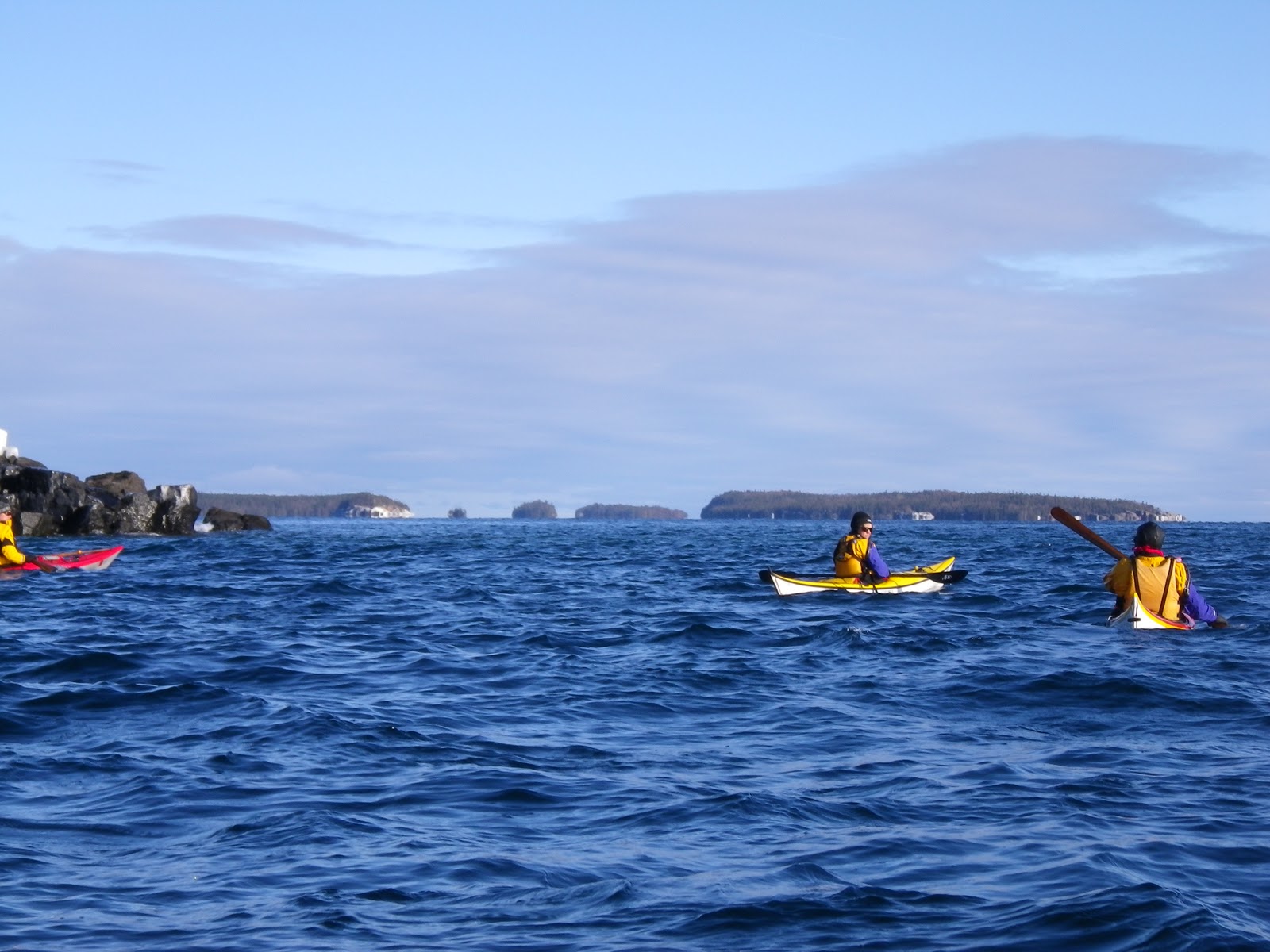
On Day 1 of the paddling portion of the trip, we arrived at Crooked River State Park in plenty of time and got our boats and gear ready.  As soon as the tide turned, we set off down the Crooked River.  We crossed Cumberland Sound (part of the Intracoastal waterway), then paddled into the Brickhill River and stopped for lunch at Plum Orchard, which was the first of the three mansions we would see.
 
Thomas Carnegie (brother of Andrew) and his wife Lucy bought property on Cumberland Island in the 1880s, and built the family mansion (Dungeness) on the southern part of the island.  Thomas died relatively young, and Lucy became the matriarch of a large clan and the social center of the island.  As her children came of age and married, she built several of them mansions of their own.  (Bachelor sons, however, did not get mansions.)  Plum Orchard was the mansion built for son George.  A volunteer park ranger gave us a tour.  It was impressive, with cutting edge amenities for the turn of the century: refrigeration, electricity with DC current inside of wooden conduits, indoor plumbing that wouldn't look out of place today, indoor pool, squash tennis court.  There were buttons to summon the servants, and of course, separate stairways for the servants.  What really made the enormity of the family wealth sink in was realizing that this was a secondary residence, used only a few months a year.
 
After lunch and tour, we paddled on to our first campsite at Brickhill Bluff.  It's interesting how names conjure up images in our minds.  The bluff I imagined was much grander than the actual bluff, but it was still a fine campsite. We took a walk through the live oak woods before dinner.  A grape vine was spotted and 3 of the guys jumped from a tree a la Tarzan to swing on it.  At dinner we enjoyed the first of the delicious meals prepared by chef Ryan … fish and shrimp.

We put the tarp up over the "kitchen" before we went to bed, and the rain started during the night.  Fortunately it had just about quit by the time we got up the next morning, and the rest of the trip was good weather.
 
Day 2 required an early start to get through Christmas Creek at high water and on the flood tide, so we were up at 4 and launched at 7.  We took a shortcut through Mumford Creek, then were back on the Brickhill river. 
 
The entrance to Christmas Creek was not obvious … we made our way through some reeds and eventually got to the point where the creek became well defined.  The creek provided a shortcut to the Atlantic side of the island, allowing us to avoid paddling all the way north around the tip of Little Cumberland Island.  With few landmarks to use to find our position in the salt water marsh, we used the hammocks (areas of high ground with trees growing on them) that were marked on the charts.
 
Just before Christmas Creek opened up into the Atlantic, we landed to take a break and hike over the dunes to scout our exit route.  The creek was flowing out, the tide was ebbing, and there was an off shore wind, so creek, tide and wind were all moving east.  The swells were coming from the east and pilling up on the sand shoal that stretched out from the creek entrance.  The result was surf that seemed pretty big in a little kayak.  We needed to turn south (right) as soon as we reached the Atlantic, and the main shoal was dead center as we left the creek, so the plan was to keep to the right to avoid the worst of the surf.
 
But things didn't go quite according to plan.  With the current, tide, and wind all moving us east, the group unintentionally ended up in the center of the shoal, and paddling into the biggest breaking waves.  You also want to hit the waves more or less head on, increasing the tendency to stay in the center.
 
I was towards the rear, with Ryan behind us, and he told those of us who were close to him to move right, which we did.  It's always hard to estimate heights after the fact, but I think we were paddling up and over 5 foot waves where I was, and they were probably higher to my left.  I made it out with a bit of an adrenalin rush but no other problems.  Two of the folks who had moved farther to the center capsized.  One rolled and the other was rescued. The good thing about the rescue situation was that wind, current and tide were carrying the rescuer and swimmer out, so by the time the swimmer was back in his boat, they were in calmer conditions.  It would have been trickier if they had been carried into worsening conditions during the rescue.  Mike had done the rescue, and mentioned that in the conditions, he would have liked someone to raft up next to him to help stabilize.  Another lesson was that you need to be paying attention to the big picture, including the landmarks behind you, to know whether you're where you intended to be.
 
Regrouped and glad to be past the shoal, we paddled south, made our way through a second shoal, then stopped for lunch.  Back on the water, we crossed a third shoal and stopped while those who wanted to spent some time surfing.  It was perfect conditions … lots of green water, meaning the waves were big enough to surf on, but not breaking.  Three of us opted not to surf, and hung out in the swells waiting. 
 
Back underway, we proceeded to our Stafford Beach campsite.  As we paddled, several of us struck firm but movable objects with our paddles, which we later learned were probably cannonball jellyfish.  We saw pelicans gliding above the waves, the tips of the "wings" of numerous stingrays on the surface of the water, and several dolphins.
 
This was our longest day at 18 nautical miles (20.7 statute miles), and we were nicely tired by the time we landed.   Some folks did a bit more surfing, but I was ready to call it a day (this was my second day on the water for the season), so enjoyed watching.  Mike did an endo over one of the waves that was very impressive, though perhaps not intentional.
 
We had to carry our gear a good half mile to the camp area, but it was worth it.  The campsite was lovely, nestled in a clearing in the live oaks which we promptly hung with drying gear.  (When returning to the campsite after dark, it was easy to spot our camp with all its reflective tape.)  And there were cold showers, which were most welcome. 
 
That night we walked back down to the beach and watched the nearly full moon rising.  The moon lit up a brilliant path straight towards us.  It was also bright enough that the rest of the ocean was bathed in silver.  As the swells approached the shore and started to pile up, the front of the waves were dark bands against the silver background of the ocean.  When a wave would start to break, you would see the white foam on the top edge, and you could even see the white spray being blown back off the top of the wave by the wind and backlit by the moon. 
 
And if that wasn't magical enough, on our left 3 horses appeared -- two adults and a foal.  They wanted to cross to our right, and started walking along the beach in front of us.  Just as they passed us, they got spooked and started running, and we could feel their hooves pounding on the sand. 
 
It was hard to leave the beach that night.
 
Day 3 was a play/rest/wander day at Stafford Beach.  In the morning we took a final opportunity to surf before the swells died away.  This time I joined in and got some good coaching from Ryan. Try to keep your butt at the top of the wave so you have control.  You want to avoid moving so far down the wave that your bow gets locked in, but stay far enough forward to remain on the wave. Steer away from the breaking wave and towards the green water.  If you get caught in the break, you really have to commit to your brace.  I was bracing the right way, but not hard enough, and eventually would get knocked over by a stray bounce (fortunately, I rolled every time).  I still find it all much easier said than done, especially when I only do it once every 6 months.
 
Apres surf was a yummy brunch (individual omelets, fried potatoes and fresh fruit), then we split up for afternoon adventures.  Geoff, Scott and I walked inland and took a look at Stafford House, a mansion that is still in use.
 
Dinner was individual pizzas with crusts made from yeast dough.  That evening was the official full moon, and we went down to the beach again.  We didn't see the moon at first since there was haze on the horizon.  As an astronomy major, I was starting to feel personally responsible for the absence of the moon.  Eventually we saw a lighter spot in the haze, and the moon suddenly appeared as a horizontal orange slice, with top and bottom still obscured by haze and clouds.  As it rose above the haze, it whitened up.  The surf was minimal at that point, so it was a lovely evening but not quite as magical as the previous night.
 
Day 4 we launched at 8 to get to the south end of the island by high tide.  We had to cross a jetty, and needed high water to do so.  We paddled easily along miles of sand beach, enjoying the day and the sun and the water and the dolphins and the birds. 
 
I wasn't quite sure what the jetty would be like.  Turned out to be a line of big, sharp, black rocks that didn't seem to be at all friendly to kayaks.  We found a low spot and crossed one at a time, waiting for a swell to ride over the rocks.  In between swells, the rocks were uncovered and looked eager to take a large bite out of a kayak.
 
Ryan tried a more challenging spot to cross and didn't quite make it.  We were focused on our spot and heard a crunch to our right and saw his bow sitting up on a rock.  We landed on the other side of the jetty to put a patch on his bow, but Explorers are tough boats and the damage looked superficial..
 
Then we crossed Cumberland Sound to the Florida side (half a mile or so) and landed below Fort Clinch, a brick fortress built before and during the Civil War.  It was obsolete before it was completed.  Preserved and renovated by the CCC during the 1930s, it's now a state park.
 
After eating lunch on the ramparts among the cannons and exploring the fort, it was time to cross back to Cumberland Island.  This would be a trickier crossing. Coming over we were near slack tide.  Going back, we were facing a 3 knot current from our left.  Once we crossed the sound and started to head up the west side of the island, the ebb current would be directly against us, though it would be slowing as the afternoon went on. 
 
We started trying to ferry across, but half way there we decided to accept the drift, get to the far side, and eddy hop against the current. 
 
Working our way up the west side of the island, we stopped at Dungeness Mansion.  It had burned in a huge fire in 1959, but even the ruins were impressive. 
 
Then it was on to Sea Camp, where we would stay on our final night. We hung out while Ryan made sure there was a campsite available, then landed on the dock and carried our gear up.  Like Stafford Beach, Sea Camp has a long walk between dock and campsites, but they had carts we could load our gear on.
 
Ryan prepared another yummy dinner, and for dessert an instant cheese cake that disappeared in less than 2 minutes after it was pronounced ready to eat.  No plates were dirtied in the consumption of that cheesecake.
 
The morning of Day 5 we headed back up Cumberland Sound to the Crooked River park where we had started.  At one point we watched a flock of birds (pelicans?) fly past us in a line.  The bird in front stopped flapping its winds and started gliding, then the next bird, then the next bird, one after another.  Then the lead bird started flapping its wings again, and the others followed one at a time just like fans in a stadium doing the wave.
 
And then … we were back at the launch site.  We loaded the trailer, stopped for showers, and went out for lunch.  Mike and Scott were kind enough to drop me at the Savannah airport on their way home.

There's always that moment at the beginning of a trip when you cross the line from anticipation into commitment to the adventure and whatever it brings.  And there's always that moment of sadness at the end when you and your companions are saying goodbye and parting ways, and the adventure turns into memories. But memories and new friends are both good things.  Until the next adventure…

Pictures are here